Phoenix Hill

Phoenix Hill

Phoenix Hill

Phoenix Hill

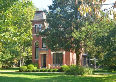
The area originally known as Uptown was settled by German immigrants and was annexed by Louisville in 1827. It was densely populated by the time of the Civil War.

E. Broadway was once lined with grand residences and commercial structures and was compared to the finest residential boulevards of the world.

Some of the city’s Bloody Monday election day riots occurred in the neighborhood near the St. Martin of Tours church on August 6, 1855 when Protestant mobs attacked German and Irish Catholic neighborhoods. The riots had grown out of a rivalry between two political parties.

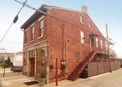
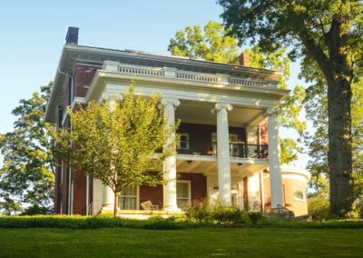
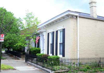
After World War II the neighborhood saw decades of mass demolition. The south side of the 800 block is the only almost intact blockface left on E. Broadway. The area today shows very little resemblance of what it had once been.

A last of the city’s municipal street markets closed in 1888 and The Haymarket was established on a block between Jefferson, Liberty, Floyd and Brook Sts. Truck farmers and hucksters, many who were Italian and Lebanese immigrants, sold fruits, vegetables and other products to wholesalers and consumers. In the 1920s the open sheds were covered for weather protection but the Haymarket began its decline in the 1940s with the rise of chain groceries and closed in 1962. The Haymarket district continued until early 2000s, mainly selling Christmas trees and wholesale produce.

Urban renewal claimed a large portion of the western portion of the neighborhood for the largest public housing project ever built in the state in 1939, and again later in the late 1950s for Interstate 65, followed by the medical district expansion.

Today, the area contains the city’s most diverse mix of business, industry and residential. The East Market District, also known as NuLu, is an eclectic mix of restaurants, retail stores, and galleries.

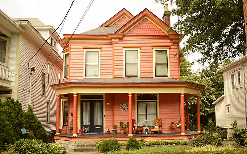
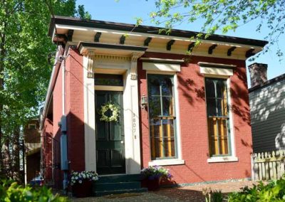
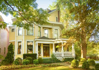
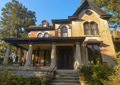
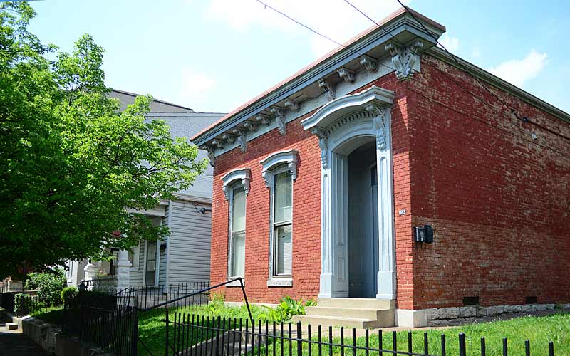
Some late Federal and Italianate structures still exist, with wood-frame shotguns being the most common style.

Some noteworthy sites:
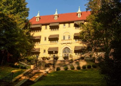
800 E. Chestnut St. at Shelby, former Ursuline Academy Chapel, Romanesque Revival, c. 1867-68
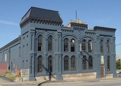
200 block S Clay St., some of the oldest remaining commercial structures downtown.
St. Martin of Tours Catholic Church, 639 S Shelby St., Gothic Revival, c. 1853, had a newer facade added about 1900.

Boundaries are Jefferson St. to the north, Preston St. to the west, Broadway to the south, and Baxter Ave. to the east.
www.phoenixhillna.org

National Register of Historic Places

advertisment

GALLERY

Clifton

Clifton

Clifton

Clifton

Named for the hilly location on the Ohio River valley escarpment. The Louisville and Shelbyville Turnpike (c. 1818) was built upon a high ridge, on a trail originally formed by migrating buffalo, it followed the path of what is now Frankfort Ave. By the 1830s, Clifton was mostly farmland. In the late 1840s, construction of the Louisville and Frankfort Railroad converged at what became the heart of Clifton and followed a path parallel to the toll road east. Both of these events shaped the historic and architectural continuum in Louisville’s development eastward.

The earliest residences were farmhouses or rural retreats for the wealthy and pre-date any formal grid street pattern. Most of the houses were constructed from 1870 to 1930 and share consistent lot size and styles with adjacent houses.

Clifton’s earliest building is the Three Mile Tollhouse (c. 1830), where the tollgate keeper lived. In the early 1900s, it served as a police substation/jail, and has housed restaurants since 1933.

The Rastetter House (c. 1845) is the earliest surviving farmhouse in the area. Unfortunately, all traces which reflect antebellum farmhouse styles were compromised by extensive alterations. The main entrance was re-oriented away from the old turnpike and now faces Payne St.

Adding to the patina of the Clifton neighborhood are a variety of textures that include brick streets and sidewalks, limestone curbs, iron fences, stone walls, and the Chicken Steps. There were several quarries in the area that were active in the late 1800s until the early 1900s, none are used for their original purpose, but the quarry walls are still visible.

Commercial buildings in the neighborhood run the spectrum of architectural styles popular between the years 1830 to the 1950s, but beginning in the 1920s buildings no longer had a “zero-setback” from the sidewalk, and instead were set back to allow for “front yard parking”. In addition, business owners often demolished adjacent buildings to accommodate more automobile parking, it is the evidence of the evolution of the Frankfort Ave. corridor from a pedestrian-oriented street to the automobile-oriented corridor that it is today.

The area has been revitalized since the 1990s, as restaurants, boutiques, and small shops have opened along the Frankfort Ave corridor.

Clifton is bounded by Brownsboro Rd. on the north, N. Ewing Ave. on the east, I-64 on the south, and Mellwood Ave. on the west.

Noteworthy sites:
Kentucky School for the Blind & the American Printing House for the Blind 1867 Frankfort Ave.
Albert A. Stoll Firehouse (The Silver Dollar), 1761 Frankfort Ave.
Spect’s Saloon (Bourbons Bistro), Italianate, c. 1887, 2255 Frankfort Ave.
Widman’s Saloon & Grocery (Irish Rover Pub) Italianate, c. 1858, 2319 Frankfort Ave.
Three Mile Tollhouse (Ray Parella’s) Federal vernacular, c. 1830,  2311 Frankfort Ave.
St. Frances of Rome School (Clifton Center), 2117 Payne St.
Rastetter House (private residence), c. 1845, 2213 Payne St.

www.cliftonlouisville.org

Louisville Historic Preservation & Urban Design

advertisment

GALLERY

Strathmoor

Strathmoor

Strathmoor

Limerick

Small cities and neighborhoods centered around Bardstown Rd., between I-264, Taylorsville Rd., and Lakeside Dr. in the upper Highlands.

Strathmoor Manor, Strathmoor Village, Strathmoor Gardens, Kingsley and Wellington make up an area loosely referred to as Strathmoor in the area near Bardstown Rd., and just south of Taylorsville Rd., near Bowman Field.

Strathmoor Gardens was annexed by the City of Strathmoor Village in 1993, part of the saga of suburban politics.

The building styles are very eclectic, and signaled the beginning of the end of old-fashioned craftsmanship in building arts in Louisville as more mass produced products became readily available.

Strathmoor Manor, to the south of Bardstown Rd. was created in the 1920’s and was advertised as an ‘airplane subdivision’, given it’s proximity to Bowman Field, the oldest continually operating commercial airfield in North America.

All of the homes share a common historical element of being created in the age of the automobile.

advertisment

GALLERY

Belknap

Belknap

Belknap

Belknap

In 1790 a family settled in this area from Europe. A house remains from their farm on and their family cemetery is on Bardstown Rd. where Doup and Kaelin Aves. meet.

In 1801, Jonathan Clark, older brother of George Rogers and William, built the original part of the house on 1,000 acres, at 1840 Trough Springs, and gave the acreage its name from a spring on the property. The original core of house remains intact.

The Zimlich brothers owned 80 acres between Dundee Rd. and Sewanee Dr. and ran a stage coach stop there from 1847 to 1901. A young Abraham Lincoln was known to frequent the Douglass Loop Tavern during his visits to the area in 1841. It was one of the first commercial strips along what is now Bardstown Road. The area includes the Douglass Loop and continues on Bardstown Road to St. Francis of Assisi Church. St. Francis built their first church there in 1886 where sermons were preached in German until 1910.

In the 1920’s the neighborhood evolved from grid to a curvilinear type development, and had restrictions on building materials – no frame construction was permitted.

Although much of the neighborhood had been developed before the crash of ’29, there were still many lots available. Consequently, a 1920’s house can be found next to a 1940’s house which created an interesting in-fill, often making it difficult to tell the age of a house.

The Belknap School Building, c. 1916, is on the National Register. The exterior terra cotta ornamentation make it one of the city’s finest examples of Sullivanesque detailing.

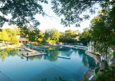
Lakeside Swim Club, originally Kaelin’s Quarry, was founded in 1924 and is surrounded by forty-foot cliffs. The quarry is filled with 3.2 million gallons of water. The original spring house is at 2147 Lakeside Drive.

The Douglass Loop streetcar turnaround was used from 1912 until 1948. The Douglass Loop is the only remaining loop in the city.

Opened in 1926, The Loop Barber Shop is the oldest continuously operating barber shop in the city.

Douglass Loop’s Twig and Leaf, a 1961 roadside diner of modern design, was one of the first modern structures to be designated a local landmark in the city.

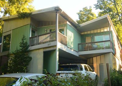
Built in 2001, the Wyatt house on Ravinia Ave. is considered an architecturally significant house for its modern design.

Warheim Park is a neighborhood green space at Overlook Terrace, Yale Dr. and Boulevard Napoleon.

Corporations have targeted Belknap for development due to its central location, favorable demographics, and proximity to the urban core. The Belknap Neighborhood has been very successful in controlling intrusion in their neighborhood.

Recognized as one of the most livable and lovable neighborhoods in America, it is the largest neighborhood in the Highlands.

www.belknapneighborhood.org

advertisment

GALLERY

Highlands-Douglass

Highlands-Douglass

Highlands-Douglass

Highlands-Douglass

One of many neighborhoods that emerged in the early 20th century from rolling farmland and scattered family estates as growth moved outward from downtown as the trolley line was extended out Bardstown Rd. to Taylorsville Rd.

One of the earliest estates in the area was Woodbourne, a 200 acre estate assembled during the 1830s, part of that property was donated to create Cherokee Park The original estate home still stands near the intersection of Bardstown Rd. and Woodford Place.

The more level terrain western portion of the neighborhood developed quicker than the eastern portion and the original subdivision was carved into several smaller subdivisions prior to World War I and again in the 1920s. The housing styles in each subdivision reflects the socio-economic status of the original residents. Large historical revival homes (Colonial, Tudor, etc.) in the western portion suggest an affluent upper-middle class population, while the bungalows of the southern portion, near the intersection with Taylorsville Rd., indicate a more middle class population.

The western section of the neighborhood featured a street pattern which represented a departure from the original grid style subdivisions. In addition to showing a greater respect for the natural topography of the land, there was a growing trend towards subdivision design which included large lots, encouraged natural topography, and preferred street patterns which discouraged through traffic in residential neighborhoods. This proved to be more profitable in the long run as well as more appealing to affluent home buyers.

The prevalence of more contemporary style homes and ranch houses along with the occasional historical revival home along Carolina Avenue, Moyle Hill Rd., Millvale Rd., and Valletta Ln. are an indication of the numerous subdivisions and re-subdivisions that took place.

The neighborhood is generally bounded by Speed Ave. on the north, Cherokee/Seneca Park on the east, Eastview Ave. on the south, and Bardstown Rd. on the west.

www.highlandsdouglass.org

advertisment

Cherokee Triangle

Cherokee Triangle

Cherokee Triangle

Cherokee Triangle

The Highlands was the last area near downtown to be urbanized, since the 60 foot incline above the flood plain made travel difficult, the area had no sign of urban development until just before the Civil War. Notable families owned plantations in the area, spurred by the Louisville and Bardstown Turnpike.

The neighborhood became an early streetcar suburb in the 1880s, which was extended down Bardstown Road after early residents of Cherokee Rd. protested the trolley line. Businesses formed along the old turnpike, surrounded by residential development. The growth would creep down Bardstown Rd. as the streetcar lines were extended. By the 1930s, the entire area we call the Highlands had been developed. Streetcars last ran down Bardstown Rd. in 1947.

Much of Cherokee Triangle was originally part of a city called Enterprise, which had incorporated in 1884 for tax reasons, and to keep liquor sales out of the community. The city was annexed by Louisville in 1896.

Many wealthy residents left for new suburbs after World War II, and as was typical of older affluent neighborhoods such as Old Louisville, large multi-story buildings were split up into apartments. The Cherokee Triangle Association formed in 1962, and new rules and down-zoning slowed the trend with suburban-style zoning restrictions, partially to prevent developments such as new apartment complexes that were seen as out of place.

The preservation district designation came in 1975 after “incompatible intrusion” by developers. Largely as a result of the preservation district status, the neighborhood has undergone a period of sustained gentrification, and has had the greatest appreciation of property values in the city.

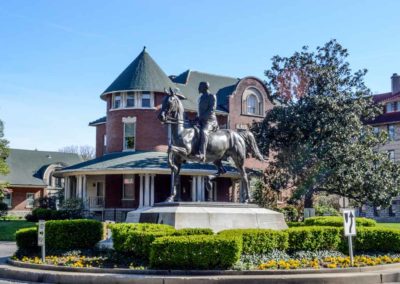
The neighborhood is known for Cave Hill Cemetery (1848), Cherokee Park (1891), and its annual art fair, held the weekend before the Kentucky Derby. A local landmark was the statue of General John Breckinridge Castleman, removed in 2020 after protests.

The historic district is bounded by Cave Hill Cemetery on the north, Cherokee Park on the east, Eastern Pkwy. on the south, and Bardstown Rd. on the west.

www.cherokeetriangle.com
Louisville Historic Preservation & Urban Design

advertisment

GALLERY