Clifton

Named for the hilly location on the Ohio River valley escarpment. The Louisville and Shelbyville Turnpike (c. 1818) was built upon a high ridge, on a trail originally formed by migrating buffalo, it followed the path of what is now Frankfort Ave. By the 1830s, Clifton was mostly farmland. In the late 1840s, construction of the Louisville and Frankfort Railroad converged at what became the heart of Clifton and followed a path parallel to the toll road east. Both of these events shaped the historic and architectural continuum in Louisville’s development eastward.
The earliest residences were farmhouses or rural retreats for the wealthy and pre-date any formal grid street pattern. Most of the houses were constructed from 1870 to 1930 and share consistent lot size and styles with adjacent houses.
Clifton’s earliest building is the Three Mile Tollhouse (c. 1830), where the tollgate keeper lived. In the early 1900s, it served as a police substation/jail, and has housed restaurants since 1933.
The Rastetter House (c. 1845) is the earliest surviving farmhouse in the area. Unfortunately, all traces which reflect antebellum farmhouse styles were compromised by extensive alterations. The main entrance was re-oriented away from the old turnpike and now faces Payne St.
Adding to the patina of the Clifton neighborhood are a variety of textures that include brick streets and sidewalks, limestone curbs, iron fences, stone walls, and the Chicken Steps. There were several quarries in the area that were active in the late 1800s until the early 1900s, none are used for their original purpose, but the quarry walls are still visible.
Commercial buildings in the neighborhood run the spectrum of architectural styles popular between the years 1830 to the 1950s, but beginning in the 1920s buildings no longer had a “zero-setback” from the sidewalk, and instead were set back to allow for “front yard parking”. In addition, business owners often demolished adjacent buildings to accommodate more automobile parking, it is the evidence of the evolution of the Frankfort Ave. corridor from a pedestrian-oriented street to the automobile-oriented corridor that it is today.
The area has been revitalized since the 1990s, as restaurants, boutiques, and small shops have opened along the Frankfort Ave corridor.
Clifton is bounded by Brownsboro Rd. on the north, N. Ewing Ave. on the east, I-64 on the south, and Mellwood Ave. on the west.
Noteworthy sites:
Kentucky School for the Blind & the American Printing House for the Blind 1867 Frankfort Ave.
Albert A. Stoll Firehouse (The Silver Dollar), 1761 Frankfort Ave.
Spect’s Saloon (Bourbons Bistro), Italianate, c. 1887, 2255 Frankfort Ave.
Widman’s Saloon & Grocery (Irish Rover Pub) Italianate, c. 1858, 2319 Frankfort Ave.
Three Mile Tollhouse (Ray Parella’s) Federal vernacular, c. 1830, 2311 Frankfort Ave.
St. Frances of Rome School (Clifton Center), 2117 Payne St.
Rastetter House (private residence), c. 1845, 2213 Payne St.
www.cliftonlouisville.org
Louisville Historic Preservation & Urban Design
GALLERY
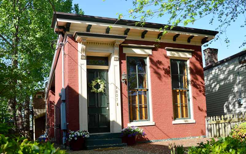
Camelback shotgun
1807 Frankfort Ave.
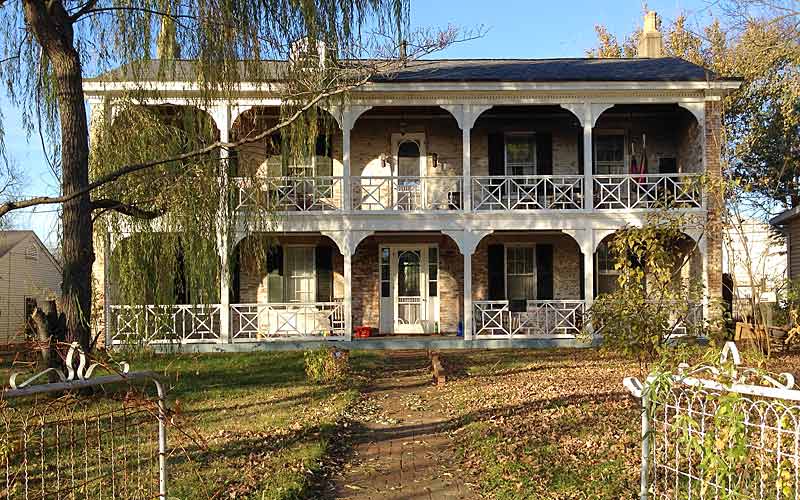
Rastetter House
2213 Payne St.