Portland

Aneighborhood and former independent town northwest of downtown Louisville. Situated along a bend of the Ohio River just below the Falls of the Ohio, where the river curves to the north and then to the south, at the northwester tip of urban Louisville. In its early days it was the largest of the six major settlements at the falls, the others being Shippingport and Louisville in Kentucky, and New Albany, Clarksville, and Jeffersonville on the Indiana side.
Laid out in 1811, with a northeast to southwest street grid between what is now 36th and 33rd Street along the Ohio River, and included a large wharf. The settlement quickly grew to the east, in a northwest to southeast street grid, which noticeably contrasts to the east-west grid of adjacent areas of Louisville.
The advent of steamboats on the Mississippi occurred simultaneously with Portland’s development, allowing the Ohio River to be used as a major freight shipping route in what was then the American frontier. Portland was located just downstream from the only natural obstacle on the Ohio River, so all large boats traveling on the Ohio had to stop to move their freight by land around the Falls and reload them on another boat. Portland’s wharf flourished with taverns, warehouses, and shipyards. By 1814 French immigrants had begun populating the town.
Portland became a rival of Louisville and the nearby settlement of Shippingport. The three were connected by a road in 1818 called the Louisville & Portland Turnpike, which became Portland Ave.
In 1830 the Louisville and Portland Canal was completed around the Falls, causing many of the warehouses and shipyards to close and shifted economic power on the Falls to nearby Louisville, although Portland continued to grow as many French and Irish immigrants moved there.
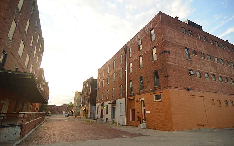
Portland continued to flourish into the 1930s when the largest Ohio River flood in recorded history occurred in 1937 and inundated all of Portland, with areas closest to the river being nearly wiped out. Plans began immediately to protect the area with a flood wall, but World War II occupied the priority of the government’s engineers. Eight years later in 1945 the second largest flood in Louisville’s history occurred. In its aftermath all areas of Portland nearest to the river were razed, including the Portland Wharf, and a gigantic flood wall was built to a height three feet above the level of the 1937 flood. Despite the loss of many of area’s oldest buildings to the floodwaters, portions of the neighborhood away from the flood wall were largely untouched by urban renewal, and retain a great number of pre-Civil War era buildings. Although many older mansions still exist in Portland, the vast majority of homes built in the area were shotgun houses.
Boundaries are the Ohio River along the northwest, north, and northeast, 10th St. on the east, Market St. on the south, and the Shawnee Golf Course on the west.
GALLERY
Looking west on Lytle St.
Lytle St. & N. 15st.
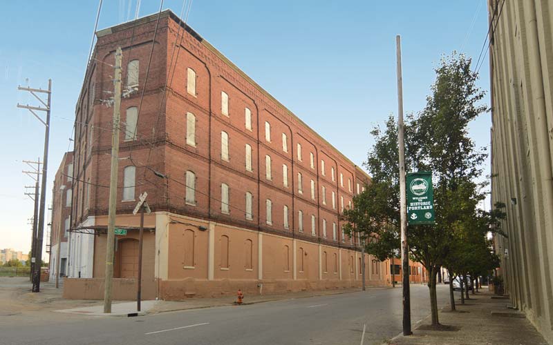
Looking south on 15th
N. 15th & Portland Ave.
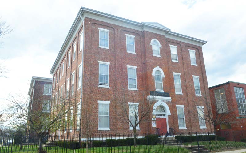
Roosevelt School
220 N. 17th @ Duncan
Cast iron balcony
Rudd Ave. near Cedar Grove Terrace
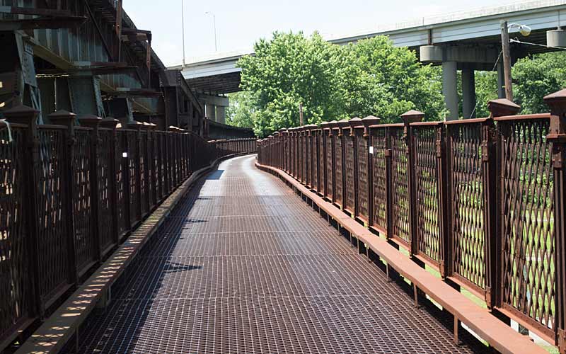
K & I Bridge
Closed to vehicular traffic in 1970s
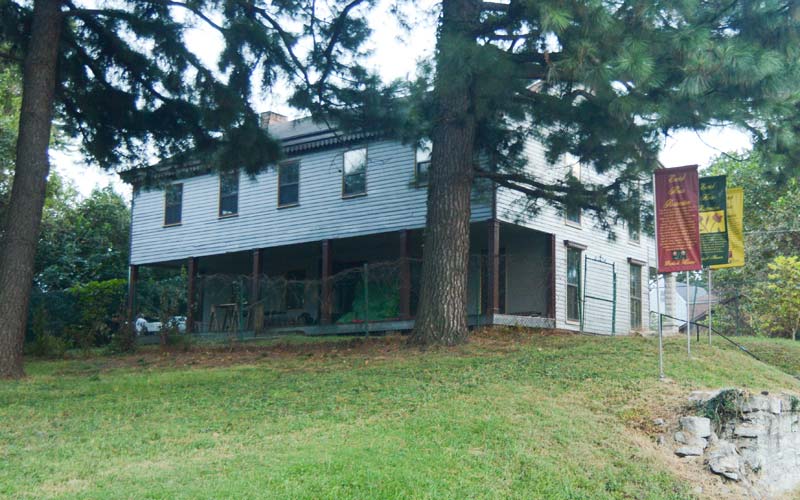
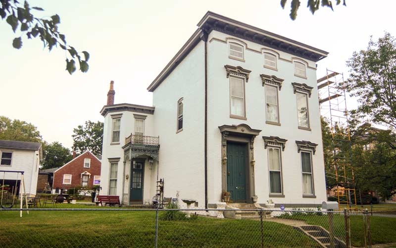
The Earich House
Built sometime between 1811 & 1827, it is thought to be the oldest house in Portland.