Strathmoor

Strathmoor

Strathmoor

Limerick

Small cities and neighborhoods centered around Bardstown Rd., between I-264, Taylorsville Rd., and Lakeside Dr. in the upper Highlands.

Strathmoor Manor, Strathmoor Village, Strathmoor Gardens, Kingsley and Wellington make up an area loosely referred to as Strathmoor in the area near Bardstown Rd., and just south of Taylorsville Rd., near Bowman Field.

Strathmoor Gardens was annexed by the City of Strathmoor Village in 1993, part of the saga of suburban politics.

The building styles are very eclectic, and signaled the beginning of the end of old-fashioned craftsmanship in building arts in Louisville as more mass produced products became readily available.

Strathmoor Manor, to the south of Bardstown Rd. was created in the 1920’s and was advertised as an ‘airplane subdivision’, given it’s proximity to Bowman Field, the oldest continually operating commercial airfield in North America.

All of the homes share a common historical element of being created in the age of the automobile.

advertisment

GALLERY

Belknap

Belknap

Belknap

Belknap

In 1790 a family settled in this area from Europe. A house remains from their farm on and their family cemetery is on Bardstown Rd. where Doup and Kaelin Aves. meet.

In 1801, Jonathan Clark, older brother of George Rogers and William, built the original part of the house on 1,000 acres, at 1840 Trough Springs, and gave the acreage its name from a spring on the property. The original core of house remains intact.

The Zimlich brothers owned 80 acres between Dundee Rd. and Sewanee Dr. and ran a stage coach stop there from 1847 to 1901. A young Abraham Lincoln was known to frequent the Douglass Loop Tavern during his visits to the area in 1841. It was one of the first commercial strips along what is now Bardstown Road. The area includes the Douglass Loop and continues on Bardstown Road to St. Francis of Assisi Church. St. Francis built their first church there in 1886 where sermons were preached in German until 1910.

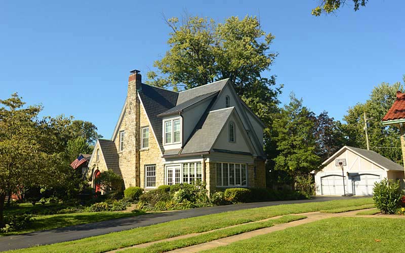
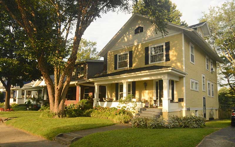
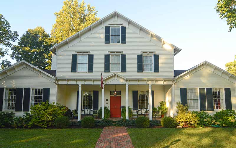
In the 1920’s the neighborhood evolved from grid to a curvilinear type development, and had restrictions on building materials – no frame construction was permitted.

Although much of the neighborhood had been developed before the crash of ’29, there were still many lots available. Consequently, a 1920’s house can be found next to a 1940’s house which created an interesting in-fill, often making it difficult to tell the age of a house.

The Belknap School Building, c. 1916, is on the National Register. The exterior terra cotta ornamentation make it one of the city’s finest examples of Sullivanesque detailing.

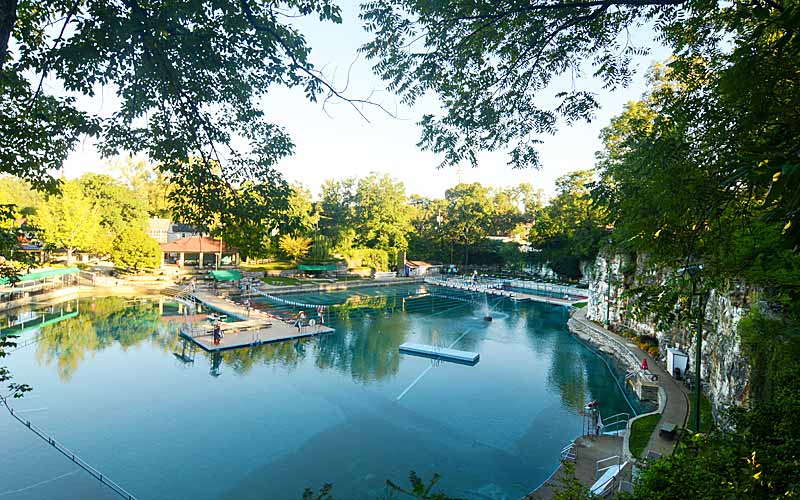
Lakeside Swim Club, originally Kaelin’s Quarry, was founded in 1924 and is surrounded by forty-foot cliffs. The quarry is filled with 3.2 million gallons of water. The original spring house is at 2147 Lakeside Drive.

The Douglass Loop streetcar turnaround was used from 1912 until 1948. The Douglass Loop is the only remaining loop in the city.

Opened in 1926, The Loop Barber Shop is the oldest continuously operating barber shop in the city.

Douglass Loop’s Twig and Leaf, a 1961 roadside diner of modern design, was one of the first modern structures to be designated a local landmark in the city.

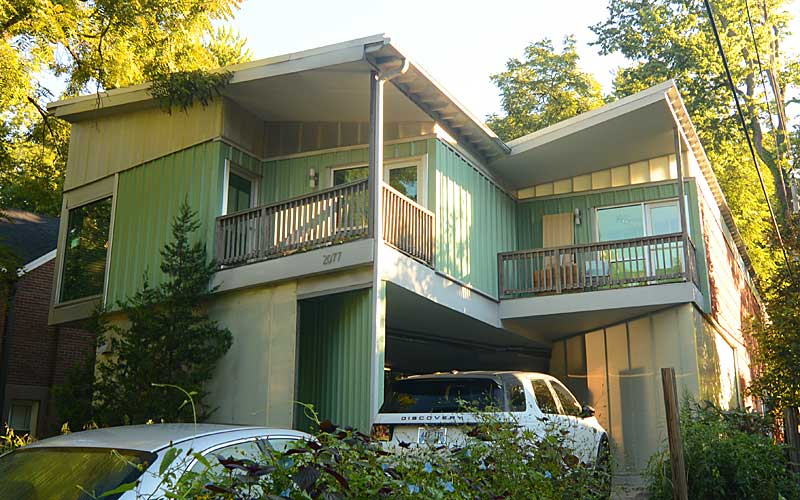
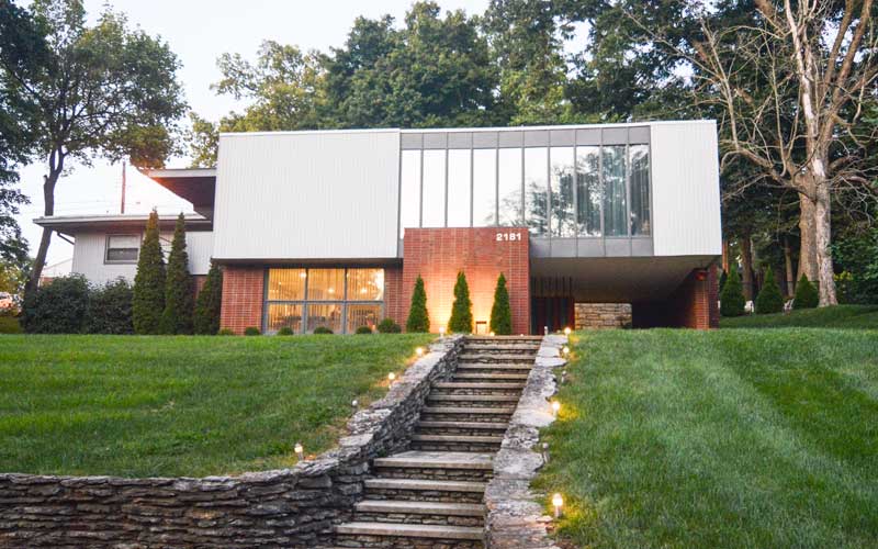
Built in 2001, the Wyatt house on Ravinia Ave. is considered an architecturally significant house for its modern design.

Warheim Park is a neighborhood green space at Overlook Terrace, Yale Dr. and Boulevard Napoleon.

Corporations have targeted Belknap for development due to its central location, favorable demographics, and proximity to the urban core. The Belknap Neighborhood has been very successful in controlling intrusion in their neighborhood.

Recognized as one of the most livable and lovable neighborhoods in America, it is the largest neighborhood in the Highlands.

www.belknapneighborhood.org

advertisment

GALLERY

Highlands-Douglass

Highlands-Douglass

Highlands-Douglass

Highlands-Douglass

One of many neighborhoods that emerged in the early 20th century from rolling farmland and scattered family estates as growth moved outward from downtown as the trolley line was extended out Bardstown Rd. to Taylorsville Rd.

One of the earliest estates in the area was Woodbourne, a 200 acre estate assembled during the 1830s, part of that property was donated to create Cherokee Park The original estate home still stands near the intersection of Bardstown Rd. and Woodford Place.

The more level terrain western portion of the neighborhood developed quicker than the eastern portion and the original subdivision was carved into several smaller subdivisions prior to World War I and again in the 1920s. The housing styles in each subdivision reflects the socio-economic status of the original residents. Large historical revival homes (Colonial, Tudor, etc.) in the western portion suggest an affluent upper-middle class population, while the bungalows of the southern portion, near the intersection with Taylorsville Rd., indicate a more middle class population.

The western section of the neighborhood featured a street pattern which represented a departure from the original grid style subdivisions. In addition to showing a greater respect for the natural topography of the land, there was a growing trend towards subdivision design which included large lots, encouraged natural topography, and preferred street patterns which discouraged through traffic in residential neighborhoods. This proved to be more profitable in the long run as well as more appealing to affluent home buyers.

The prevalence of more contemporary style homes and ranch houses along with the occasional historical revival home along Carolina Avenue, Moyle Hill Rd., Millvale Rd., and Valletta Ln. are an indication of the numerous subdivisions and re-subdivisions that took place.

The neighborhood is generally bounded by Speed Ave. on the north, Cherokee/Seneca Park on the east, Eastview Ave. on the south, and Bardstown Rd. on the west.

www.highlandsdouglass.org

advertisment