Tyler Park

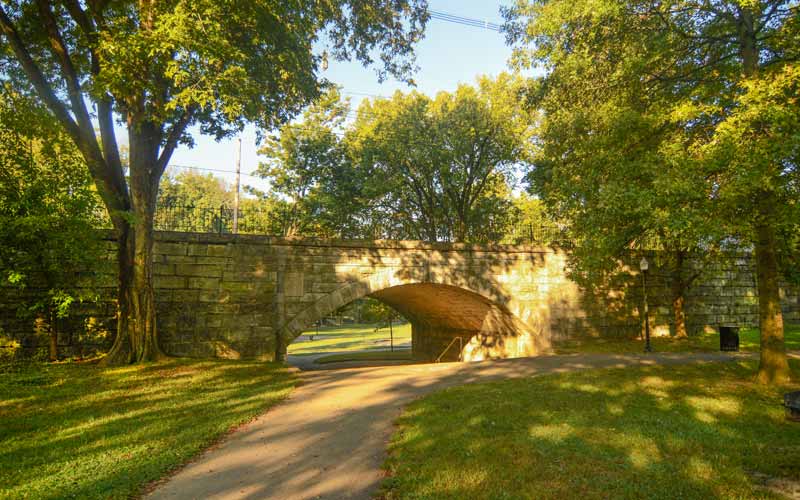
One of the city’s many Olmsted parks and the surrounding early streetcar suburb was named after the city’s mayor in the 1890s. The defining feature of the neighborhood is the stone bridge, circa 1904, which runs through the middle of the park to span a low valley where two small streams converged at the archway on the way to the south fork of Beargrass Creek at Castlewood Ave.
General John Breckinridge Castleman donated land along Castlewood Ave. that became part of the lower park and a separate tract now called the Castlewood Open Space, a short distance away.
The park and surrounding subdivisions evolved slowly, the first subdivision was laid out in 1873 on the flatter terrain between Baxter, Bardstown Rds. and Edenside Ave., but because of its relatively remote location from downtown, development did not pick up until the 1880s. The extension of a streetcar line down Bardstown Road to Bonnycastle Ave. and the establishment of nearby Cherokee Park created more demand for housing in the area.
Further west, newer sections between St. Louis and Calvary cemeteries were developed from 1907 until the 1930s with relatively strict deed restrictions on the lots, including deep setbacks, exteriors only of brick, stucco or stone, utilities and wires located in alleys, and the prohibition of wood fences.
Today, the area around Cross Rd. and Hill Rd. features some of the most eclectic and attractive residential architecture in the city.
Bounded by Rufer Ave. on the north, Bardstown Rd. on the east, Eastern Pkwy. and Calvary Cemetery on the south, and Beargrass Creek and Barret Ave. on the west.
GALLERY
Tyler Park
Baxter Ave. bridge
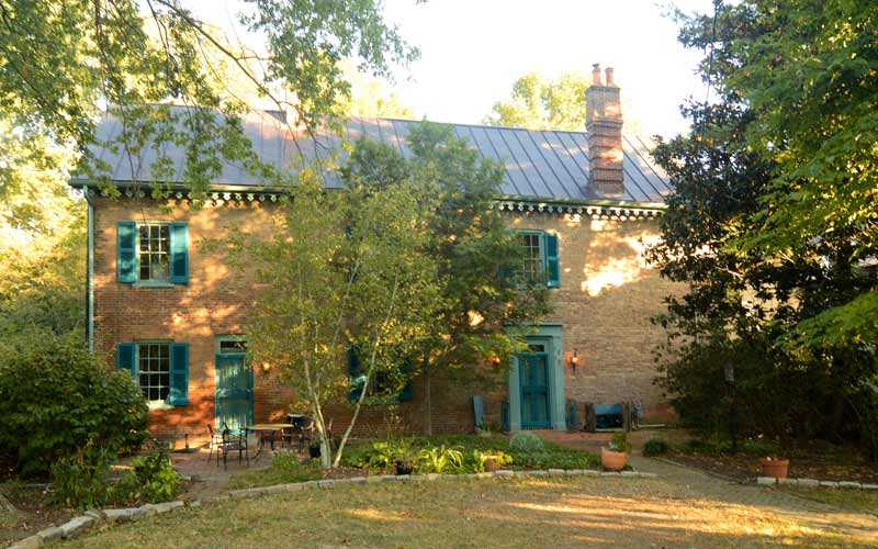
Old stagecoach stop
Castlewood Ave.
Bardstown Rd. & Edenside Ave.
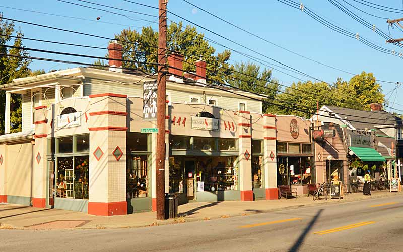
Art gallery, coffee shop, & restaurant at the sidewalk.